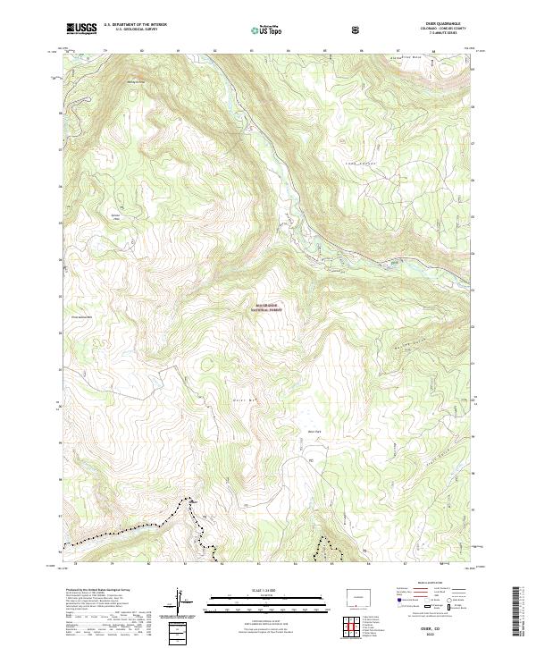
2022 Map of Osier
USGS Topo · Published 2022About this map
Osier stands as a focal point within this southern Colorado landscape, situated along the Rio de los Pinos near the New Mexico border. The area is characterized by significant topographic variation, from the high reaches of McIntyre Peak and Pinorealosa Mtn to the depths of Toltec Canyon. This 2022 survey illustrates the complex drainage network of the Rio Grande National Forest, where the Conejos River and numerous tributaries like Elk Cr and Bear Cr carve through the high-altitude terrain. Notable features such as Osier Park and Alameditas Mesa highlight the diverse landforms of Conejos County. The map also traces modern access routes such as Sheep Creek Trl and River Run Dr, reflecting the area's contemporary role for recreation and resource management while preserving the nomenclature of its early ranching and wilderness history.
Find a feature on this map
35 named features on this map. Tap any name to fly to it.
Don’t see what you’re looking for? This feature index may not catch every label — zoom into the map to look around manually.
Map Details
Editions of this 2022 Osier Map
This is the sole edition of this map. No revisions or reprints were ever made.
Other maps of this area

1918 · Tusas
USGS Topo · 1:125,000

1922 · Conejos
USGS Topo · 1:125,000

1945 · Durango
USGS Topo · 1:250,000

1953 · Durango
USGS Topo · 1:250,000

1954 · Durango
USGS Topo · 1:250,000

1954 · Aztec
USGS Topo · 1:250,000

1955 · Brazos Peak
USGS Topo · 1:62,500

1958 · Aztec
USGS Topo · 1:250,000

1961 · Durango
USGS Topo · 1:250,000

1962 · Aztec
USGS Topo · 1:250,000