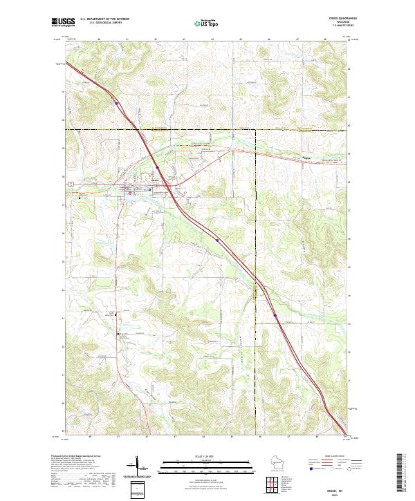
2022 Map of Osseo
USGS Topo · Published 2022About this map
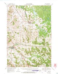
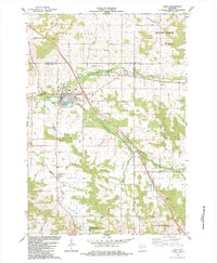
Osseo serves as the focal point of this Trempealeau County survey, situated where the S Fork Buffalo River and N Fork Buffalo River converge. The landscape is defined by its deep agricultural and genealogical roots, evidenced by the presence of the Kings Valley Lutheran Church Cem and the South Valley Cem tucked within the namesake Kings Valley. To the west, the Buffalo River State Trl follows a former rail corridor, tracing the northern bank of the Buffalo River past Marthe Lake. The transition from the town center to the outlying Golden Valley is marked by a network of rural routes like Requa Rd and Condensery Rd, which once supported the local dairy and milling economies common to this corner of Wisconsin.
Find a feature on this map
103 named features on this map. Tap any name to fly to it.
Don’t see what you’re looking for? This feature index may not catch every label — zoom into the map to look around manually.
Map Details
Editions of this 2022 Osseo Map
This is the sole edition of this map. No revisions or reprints were ever made.
Historical Maps of Sumner Through Time
5 maps found