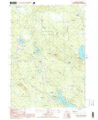
1998 Map of Ossipee
USGS Topo · Published 1999About this map
Pine River meanders through a landscape defined by glacial deposits and conservation lands at the turn of the 21st century. The map details the transition between several Carroll County towns, including Effingham, Ossipee, Wakefield, and Wolfeboro. Significant protected spaces such as Heath Pond Bog State Natural Area and the Pine River State Forest dominate the central terrain, while local industry is evidenced by numerous Sand and Gravel Pits scattered near Poland and Granite.
Find a feature on this map
53 named features on this map. Tap any name to fly to it.
Don’t see what you’re looking for? This feature index may not catch every label — zoom into the map to look around manually.
Map Details
Editions of this 1998 Ossipee Map
This is the sole edition of this map. No revisions or reprints were ever made.
Other maps of this area

1891 · Newfield
USGS Topo · 1:62,500

1893 · Newfield
USGS Topo · 1:62,500

1910 · Kezar Falls
USGS Topo · 1:48,000

1911 · Kezar Falls
USGS Topo · 1:62,500

1928 · Wolfeboro
USGS Topo · 1:62,500

1930 · Ossipee Lake
USGS Topo · 1:62,500

1933 · Newfield
USGS Topo · 1:48,000

1937 · Newfield
USGS Topo · 1:62,500

1942 · Newfield
USGS Topo · 1:62,500

1944 · Newfield
USGS Topo · 1:62,500