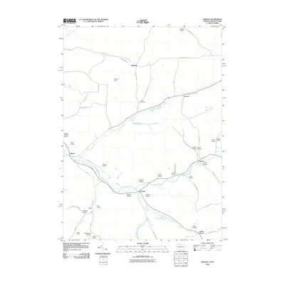
2010 Map of Oswayo
USGS Topo · Published 2010About this map
Oswayo Creek and Elevenmile Creek define the drainage of this Pennsylvania and New York borderland, where narrow valley settlements are carved into the plateau. The 2010 landscape shows established hamlets like Oswayo, Coneville, and Millport situated along these primary watercourses. To the north, the Sharon Oil and Gas Field indicates the ongoing industrial legacy of the region, while the network of named hollows—including Toad Hollow, Bunker Hollow, and Straight Hollow—reflects long-standing local nomenclature for the tributary drainages. Researchers will find a mix of agricultural and industrial land use, from the Adams Airport near the southern edge to the dispersed rural homes at Kibbeville and Hebron Center. This survey provides a precise accounting of the early 21st-century infrastructure, capturing the intersection of primary state routes with more secluded pathways such as Turkey Path Rd and Wakeley Hollow Rd.
Find a feature on this map
61 named features on this map. Tap any name to fly to it.
Don’t see what you’re looking for? This feature index may not catch every label — zoom into the map to look around manually.
Map Details
Editions of this 2010 Oswayo Map
This is the sole edition of this map. No revisions or reprints were ever made.
Other maps of this area

1925 · Belmont
USGS Topo · 1:62,500

1926 · Wellsville
USGS Topo · 1:62,500

1932 · Genesee
USGS Topo · 1:62,500

1934 · Coudersport
USGS Topo · 1:48,000

1937 · Genesee
USGS Topo · 1:62,500

1938 · Coudersport
USGS Topo · 1:62,500

1939 · Belmont
USGS Topo · 1:62,500

1950 · Elmira
USGS Topo · 1:250,000

1954 · Williamsport
USGS Topo · 1:250,000

1957 · Warren
USGS Topo · 1:250,000