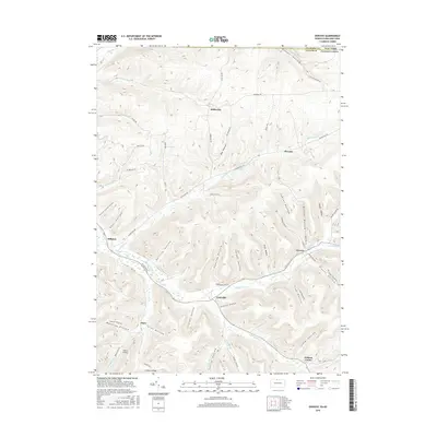
2016 Map of Oswayo
USGS Topo · Published 2016About this map
Oswayo Creek and its many tributaries, including S Br Oswayo Cr and Elevenmile Cr, define the drainage patterns of this borderland between Potter County, Pennsylvania, and Allegany County, New York. Small settlements such as Millport, Coneville, and Kibbeville sit along the valley floors, connected by a network of rural routes like Kelleytown Rd and Eleven Mile Rd. The terrain is characterized by a dense system of hollows, many bearing family names that serve as vital markers for local historians, such as Dutton Hollow, Lawson Hollow, and Tyler Hollow. Adams Airport stands as a notable landmark in the southwest near Clara, while the high ground is traversed by paths like Turkey Path Rd. The map reveals a landscape where the sharp relief of the hills has dictated the placement of roads and homesteads, maintaining a pattern of development focused on the natural corridors created by the flowing water.
Find a feature on this map
76 named features on this map. Tap any name to fly to it.
Don’t see what you’re looking for? This feature index may not catch every label — zoom into the map to look around manually.
Map Details
Editions of this 2016 Oswayo Map
This is the sole edition of this map. No revisions or reprints were ever made.
Other maps of this area

1925 · Belmont
USGS Topo · 1:62,500

1926 · Wellsville
USGS Topo · 1:62,500

1932 · Genesee
USGS Topo · 1:62,500

1934 · Coudersport
USGS Topo · 1:48,000

1937 · Genesee
USGS Topo · 1:62,500

1938 · Coudersport
USGS Topo · 1:62,500

1939 · Belmont
USGS Topo · 1:62,500

1950 · Elmira
USGS Topo · 1:250,000

1954 · Williamsport
USGS Topo · 1:250,000

1957 · Warren
USGS Topo · 1:250,000