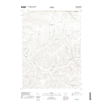
2019 Map of Oswayo
USGS Topo · Published 2019About this map
Oswayo Creek and its many tributaries carve a complex network of valleys across the state line between New York and Pennsylvania. In the southern portion of the quadrangle, small settlements like Oswayo, Coneville, and Clara follow the low-lying creek beds, connected by corridors like Kelleytown Rd and Whitney Creek Rd. The landscape is defined by its deep, narrow hollows, including Bunker Hollow, Grover Hollow, and Straight Hollow, many of which bear the names of early local families. To the north, the terrain rises toward Kibbeville and Chrystal, where the headwaters of Elevenmile Cr and Butter Cr originate. This 2019 survey documents a rural landscape where the placement of homes and roads is dictated entirely by the high ridges and water-carved valleys of Potter Co, Pennsylvania, and the adjacent border of New York.
Find a feature on this map
66 named features on this map. Tap any name to fly to it.
Don’t see what you’re looking for? This feature index may not catch every label — zoom into the map to look around manually.
Map Details
Editions of this 2019 Oswayo Map
This is the sole edition of this map. No revisions or reprints were ever made.
Other maps of this area

1925 · Belmont
USGS Topo · 1:62,500

1926 · Wellsville
USGS Topo · 1:62,500

1932 · Genesee
USGS Topo · 1:62,500

1934 · Coudersport
USGS Topo · 1:48,000

1937 · Genesee
USGS Topo · 1:62,500

1938 · Coudersport
USGS Topo · 1:62,500

1939 · Belmont
USGS Topo · 1:62,500

1950 · Elmira
USGS Topo · 1:250,000

1954 · Williamsport
USGS Topo · 1:250,000

1957 · Warren
USGS Topo · 1:250,000