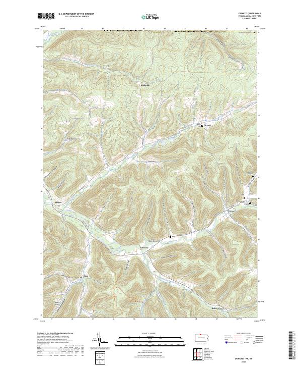
2023 Map of Oswayo
USGS Topo · Published 2023About this map
Oswayo Creek and its many tributaries, including Elevenmile Creek and Whitney Creek, define the topography of this Potter County landscape. The area is characterized by numerous named hollows that have historically dictated the placement of settlements and transport routes, such as Ross Hollow and Grover Hollow. Small hamlets like Kibbeville, Coneville, and Millport are positioned along the valley floors, while higher elevations are marked by landmarks such as Adams Airport near the southern border. For genealogists, the map is particularly useful for locating several distinct burial grounds, including the Old Brizzee Farm Cem and Rathbone Cem. This layout reflects a long-standing rural settlement pattern where agriculture and local commerce were concentrated near the water sources and within the protected valleys of the Allegheny Plateau.
Find a feature on this map
77 named features on this map. Tap any name to fly to it.
Don’t see what you’re looking for? This feature index may not catch every label — zoom into the map to look around manually.
Map Details
Editions of this 2023 Oswayo Map
This is the sole edition of this map. No revisions or reprints were ever made.
Other maps of this area

1925 · Belmont
USGS Topo · 1:62,500

1926 · Wellsville
USGS Topo · 1:62,500

1932 · Genesee
USGS Topo · 1:62,500

1934 · Coudersport
USGS Topo · 1:48,000

1937 · Genesee
USGS Topo · 1:62,500

1938 · Coudersport
USGS Topo · 1:62,500

1939 · Belmont
USGS Topo · 1:62,500

1950 · Elmira
USGS Topo · 1:250,000

1954 · Williamsport
USGS Topo · 1:250,000

1957 · Warren
USGS Topo · 1:250,000