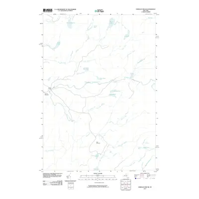
2010 Map of Oswegatchie SW
USGS Topo · Published 2010About this map
The Middle Branch Oswegatchie River defines the central hydrology of this landscape, winding past Bryants Bridge and receiving numerous tributaries including Cold Spring Creek and Mink Creek. The terrain is characterized by a dense network of water bodies and swamps, ranging from larger expanses like Trout Lake and South Creek Lake to smaller, more uniquely named features such as Scuttle Hole, Little Mudhole, and Mouldy Pond. Significant elevations like Bald Mountain and Panther Mountain provide a counterpoint to the low-lying drainage basins of Blue Swamp Creek and Burning Creek. The absence of large-scale development highlights an environment dominated by natural water systems and traditional river crossings, preserving the intricate drainage patterns of the western Adirondacks region as they appeared in the early 21st century.
Find a feature on this map
38 named features on this map. Tap any name to fly to it.
Don’t see what you’re looking for? This feature index may not catch every label — zoom into the map to look around manually.
Map Details
Editions of this 2010 Oswegatchie SW Map
This is the sole edition of this map. No revisions or reprints were ever made.
Other maps of this area

1911 · Lowville
USGS Topo · 1:62,500

1912 · Number Four
USGS Topo · 1:62,500

1913 · Lowville
USGS Topo · 1:62,500

1913 · Lake Bonaparte
USGS Topo · 1:62,500

1915 · Number Four
USGS Topo · 1:62,500

1916 · Lake Bonaparte
USGS Topo · 1:62,500

1916 · Oswegatchie
USGS Topo · 1:62,500

1918 · Oswegatchie
USGS Topo · 1:62,500

1948 · Ogdensburg
USGS Topo · 1:250,000

1950 · Utica
USGS Topo · 1:250,000