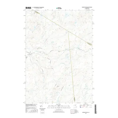
2016 Map of Oswegatchie SW
USGS Topo · Published 2016About this map
Adirondack Park Preserve lands dominate this landscape at the intersection of Lewis, St. Lawrence, and Herkimer counties. The terrain is defined by a complex network of waterways, including the Middle Branch Oswegatchie River and numerous secluded bodies of water like Silver Dawn Lake and Trout Lake. The settlement of Bryants Bridge serves as a lone named waypoint in a region primarily used for timber and conservation. A notable inclusion is Microburst Blvd, a label reflecting more modern forest management or weather event history within the older bounds of the Adirondack Park. From the heights of Bald Mtn and Panther Mtn to the low reaches of Cedar Swamp and Bear Swamp, the map illustrates a highly specific drainage pattern of creeks such as Elijah Cr and Cold Spring Cr that feed into the larger river system.
Find a feature on this map
50 named features on this map. Tap any name to fly to it.
Don’t see what you’re looking for? This feature index may not catch every label — zoom into the map to look around manually.
Map Details
Editions of this 2016 Oswegatchie SW Map
This is the sole edition of this map. No revisions or reprints were ever made.
Other maps of this area

1911 · Lowville
USGS Topo · 1:62,500

1912 · Number Four
USGS Topo · 1:62,500

1913 · Lowville
USGS Topo · 1:62,500

1913 · Lake Bonaparte
USGS Topo · 1:62,500

1915 · Number Four
USGS Topo · 1:62,500

1916 · Lake Bonaparte
USGS Topo · 1:62,500

1916 · Oswegatchie
USGS Topo · 1:62,500

1918 · Oswegatchie
USGS Topo · 1:62,500

1948 · Ogdensburg
USGS Topo · 1:250,000

1950 · Utica
USGS Topo · 1:250,000