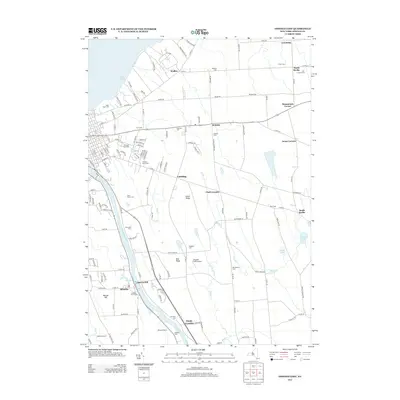
2013 Map of Oswego East
USGS Topo · Published 2013About this map
The Oswego River carves a deep valley through this landscape, serving as the primary corridor for riverfront development and local industry south of Lake Ontario. Settlements like Minetto, Seneca Hill, and Bundy Crossing align with the river's path, while the uplands to the east are defined by a network of crossroads communities including Lansing, South Scriba, and Hammonds Corner. The area's agricultural and rural character is evidenced by numerous family and community burial grounds, such as Blossom Cem and Worden Cem, scattered among the ridges.
Find a feature on this map
134 named features on this map. Tap any name to fly to it.
Don’t see what you’re looking for? This feature index may not catch every label — zoom into the map to look around manually.
Map Details
Editions of this 2013 Oswego East Map
This is the sole edition of this map. No revisions or reprints were ever made.
Other maps of this area

1900 · Oswego
USGS Topo · 1:62,500

1900 · Fulton
USGS Topo · 1:62,500

1943 · Oswego East
USGS Topo · 1:31,680

1943 · New Haven
USGS Topo · 1:31,680

1943 · Oswego West
USGS Topo · 1:31,680

1943 · Texas
USGS Topo · 1:31,680

1943 · Pennellville
USGS Topo · 1:31,680

1943 · Hannibal
USGS Topo · 1:31,680

1943 · West Of Texas
USGS Topo · 1:31,680
1943 · Fulton
USGS Topo · 1:31,680