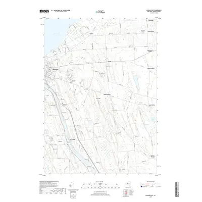
2019 Map of Oswego East
USGS Topo · Published 2019About this map
Lake Ontario borders the northern edge of this landscape where the Oswego River flows toward the city of Oswego. The terrain is defined by a series of north-south ridges, including Dutch Ridge and Deer Ridge, which dictate the drainage of smaller waterways like Wine Cr and Black Cr. This 2019 survey shows the eastern extent of the city and its surrounding rural hamlets, reflecting a mix of residential expansion and the preservation of long-established community sites.
Find a feature on this map
128 named features on this map. Tap any name to fly to it.
Don’t see what you’re looking for? This feature index may not catch every label — zoom into the map to look around manually.
Map Details
Editions of this 2019 Oswego East Map
This is the sole edition of this map. No revisions or reprints were ever made.
Other maps of this area

1900 · Oswego
USGS Topo · 1:62,500

1900 · Fulton
USGS Topo · 1:62,500

1943 · Oswego East
USGS Topo · 1:31,680

1943 · New Haven
USGS Topo · 1:31,680

1943 · Oswego West
USGS Topo · 1:31,680

1943 · Texas
USGS Topo · 1:31,680

1943 · Pennellville
USGS Topo · 1:31,680

1943 · Hannibal
USGS Topo · 1:31,680

1943 · West Of Texas
USGS Topo · 1:31,680
1943 · Fulton
USGS Topo · 1:31,680