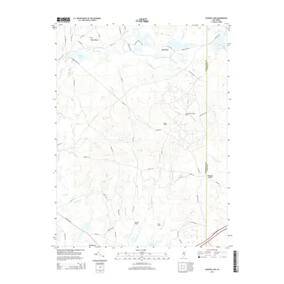
2014 Map of Oswego Lake
USGS Topo · Published 2014About this map
Oswego Lake and the Oswego River anchor this landscape along the border of Burlington and Ocean counties. The terrain is characterized by a dense network of watercourses, including Breeches Br, Beaver Br, and the forks of the Bass River. Small, historically significant settlements like Penn Place, Sim Place, and Leektown are connected by a web of sand roads and trails, such as the Batona Trl. The presence of Munion Field and the Warren Grove Range Airport suggests specialized land use within the Pine Barrens environment. Downstream, the waters collect into Lake Absegami, while crossing points like Bartletts Bridge and Dans Bridge provide key transit links through the Lower Plains. This map details the isolated reaches of the New Jersey interior before the modern expansion of coastal infrastructure.
Find a feature on this map
63 named features on this map. Tap any name to fly to it.
Don’t see what you’re looking for? This feature index may not catch every label — zoom into the map to look around manually.
Map Details
Editions of this 2014 Oswego Lake Map
This is the sole edition of this map. No revisions or reprints were ever made.
Other maps of this area

1884 · Whitings
USGS Topo · 1:62,500

1888 · Pemberton
USGS Topo · 1:62,500

1888 · Little Egg Harbor
USGS Topo · 1:62,500

1888 · Whitings
USGS Topo · 1:62,500

1890 · Mullica
USGS Topo · 1:62,500

1893 · Little Egg Harbor
USGS Topo · 1:62,500

1894 · Pemberton
USGS Topo · 1:62,500

1894 · Mullica
USGS Topo · 1:62,500

1898 · Pemberton
USGS Topo · 1:62,500

1898 · Mullica
USGS Topo · 1:62,500
Featured Places
- Stafford Township, NJ
- Little Egg Harbor Township, NJ
- Bass River Township, NJ
- Washington Township, NJ
- Penn Place, Washington Township