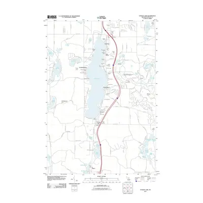
2011 Map of Otsego Lake
USGS Topo · Published 2011About this map
Otsego Lake serves as the focal point for this northern Michigan landscape, surrounded by a dense network of seasonal resorts and cabin colonies that define the region's recreational character. The shoreline is dotted with historic vacation spots like Pearll City, Arbutus Beach, and Eyedylwild Beach, while more secluded developments such as the Jo-Dey Estate are found to the west. This 2011 survey captures the area's transition into a major golf and leisure destination, featuring the Natural Golf Course, Marsh Ridge Golf Course, and The Loon Golf Course.
Find a feature on this map
166 named features on this map. Tap any name to fly to it.
Don’t see what you’re looking for? This feature index may not catch every label — zoom into the map to look around manually.
Map Details
Editions of this 2011 Otsego Lake Map
This is the sole edition of this map. No revisions or reprints were ever made.
Other maps of this area

1949 · Otsego Lake
USGS Topo · 1:62,500

1950 · Turtle Lake
USGS Topo · 1:24,000

1951 · K P Lake
USGS Topo · 1:24,000

1951 · Big Bradford Lake
USGS Topo · 1:24,000

1951 · Turtle Lake
USGS Topo · 1:24,000

1951 · Otsego Lake
USGS Topo · 1:24,000

1954 · Gaylord
USGS Topo · 1:62,500

1954 · Traverse City
USGS Topo · 1:250,000

1955 · Cheboygan
USGS Topo · 1:250,000

1956 · Alba
USGS Topo · 1:62,500