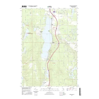
2017 Map of Otsego Lake
USGS Topo · Published 2017About this map
Otsego Lake anchors this landscape in the northern Lower Peninsula, surrounded by a dense network of shoreline settlements and glacial water bodies. The community of Gaylord sits at the northern edge, while the southern reaches center on Waters and the expansive Big Bradford Lake. The eastern half of the map is defined by an intricate cluster of smaller lakes, including Goose Lake, Ottawa Lake, and Seminole Lake, interspersed with modern residential developments and trail systems like the Pine Baron Pathway.
Find a feature on this map
96 named features on this map. Tap any name to fly to it.
Don’t see what you’re looking for? This feature index may not catch every label — zoom into the map to look around manually.
Map Details
Editions of this 2017 Otsego Lake Map
This is the sole edition of this map. No revisions or reprints were ever made.
Other maps of this area

1949 · Otsego Lake
USGS Topo · 1:62,500

1950 · Turtle Lake
USGS Topo · 1:24,000

1951 · K P Lake
USGS Topo · 1:24,000

1951 · Big Bradford Lake
USGS Topo · 1:24,000

1951 · Turtle Lake
USGS Topo · 1:24,000

1951 · Otsego Lake
USGS Topo · 1:24,000

1954 · Gaylord
USGS Topo · 1:62,500

1954 · Traverse City
USGS Topo · 1:250,000

1955 · Cheboygan
USGS Topo · 1:250,000

1956 · Alba
USGS Topo · 1:62,500