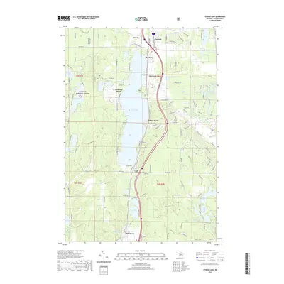
2019 Map of Otsego Lake
USGS Topo · Published 2019About this map
Gaylord anchors the northern edge of this northern Michigan landscape, where the glacial topography is defined by a dense concentration of inland lakes and the headwaters of the N Br Au Sable River. The centerpiece of the region is the elongated Otsego Lake, its eastern shore lined with residential and recreational developments like Pearll City, Oak Grove, and Arbutus Beach. To the west, the protected lands of the Manistee National Forest provide a wooded buffer for smaller water bodies such as Lake Manuka and Lake Wequos.
Find a feature on this map
81 named features on this map. Tap any name to fly to it.
Don’t see what you’re looking for? This feature index may not catch every label — zoom into the map to look around manually.
Map Details
Editions of this 2019 Otsego Lake Map
This is the sole edition of this map. No revisions or reprints were ever made.
Other maps of this area

1949 · Otsego Lake
USGS Topo · 1:62,500

1950 · Turtle Lake
USGS Topo · 1:24,000

1951 · K P Lake
USGS Topo · 1:24,000

1951 · Big Bradford Lake
USGS Topo · 1:24,000

1951 · Turtle Lake
USGS Topo · 1:24,000

1951 · Otsego Lake
USGS Topo · 1:24,000

1954 · Gaylord
USGS Topo · 1:62,500

1954 · Traverse City
USGS Topo · 1:250,000

1955 · Cheboygan
USGS Topo · 1:250,000

1956 · Alba
USGS Topo · 1:62,500