2024 Map of Ottawa
USGS Topo · Published 2024About this map
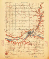
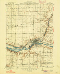
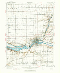
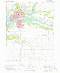
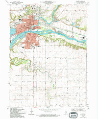
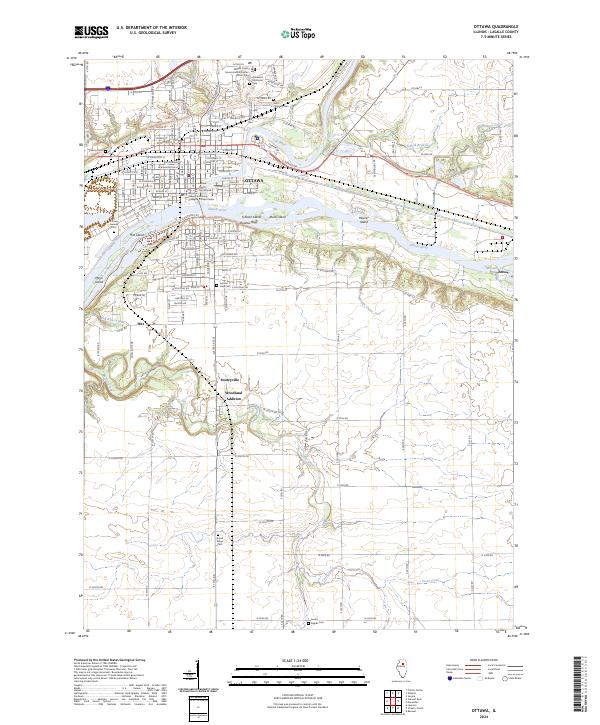
The confluence of the Illinois River and Fox River anchors this detailed study of the area surrounding Ottawa, Illinois. The landscape is defined by the significant waterway infrastructure of the Illinois valley, featuring several river islands such as Scherer Island, Bulls Island, and Hitt Island, alongside the industrial engineering of the Marseilles Canal. Civic and cultural life is centered at the LaSalle County Courthouse and the Illinois Valley Community College Ottawa Center, while the outskirts are marked by residential clusters like Stoneyville, Woodland Addition, and the small settlement at Hitt. Genealogists will find a high density of burial grounds spanning the region, including the large Ottawa Avenue Cem and Saint Columba Cem, which serve as vital touchstones for family history research in LaSalle County.
Find a feature on this map
110 named features on this map. Tap any name to fly to it.
Don’t see what you’re looking for? This feature index may not catch every label — zoom into the map to look around manually.
Map Details
Editions of this 2024 Ottawa Map
This is the sole edition of this map. No revisions or reprints were ever made.
Historical Maps of Ottawa Through Time
8 maps found