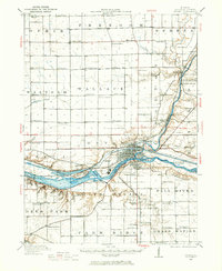
1946 Map of Ottawa
USGS Topo · Published 1966About this map
Ottawa sits at the vital confluence of the Illinois River and Fox River, serving as a busy hub of mid-century commerce and transportation. The 1946 culture revision highlights the intricate industrial and social layout of the area, from the Illinois and Michigan Canal to the active rail lines of the Chicago Rock Island and Pacific. Just west of the city, Starved Rock State Park and Buffalo Rock define the river's southern banks, while numerous family-named canyons like Kaskaskia Canyon and Tonti Canyon indicate a landscape carved by deep geological history. The surrounding prairie is densely dotted with rural schoolhouses such as Hickory College and Fullerton School, reflecting the agricultural community's commitment to local education before the era of district consolidation. Notable landmarks like the Chautauqua Grounds and Sulphur Springs point toward a history of recreation and gathering.
Find a feature on this map
112 named features on this map. Tap any name to fly to it.
Don’t see what you’re looking for? This feature index may not catch every label — zoom into the map to look around manually.
Map Details
Editions of this 1946 Ottawa Map
2 editions found

Other maps of this area

1892 · Marseilles
USGS Topo · 1:62,500

1892 · Ottawa
USGS Topo · 1:62,500

1893 · Lasalle
USGS Topo · 1:62,500

1911 · La Salle
USGS Topo · 1:62,500

1913 · La Salle
USGS Topo · 1:62,500

1915 · Ottawa
USGS Topo · 1:62,500

1916 · Marseilles
USGS Topo · 1:62,500

1925 · Streator
USGS Topo · 1:62,500

1927 · Streator
USGS Topo · 1:62,500

1934 · Wenona
USGS Topo · 1:48,000