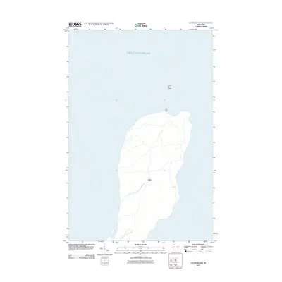
2011 Map of Outer Island
USGS Topo · Published 2011About this map
Outer Island stands as a lonely sentinel in the waters of Lake Superior, representing the northernmost reach of this Wisconsin archipelago. This 2011 survey illustrates the island's isolation, dominated by a dense interior and rugged shoreline. Near the northern tip, the Outer Island Light marks a vital point of navigation for maritime traffic navigating the expansive lake. The surrounding waters are defined by the Outer Island Shoal, a hazardous underwater feature that historically necessitated the presence of the lighthouse. Unlike more developed coastal areas, the map reveals a landscape primarily shaped by natural contours and limited human infrastructure, centered almost entirely around its navigational aids.
Find a feature on this map
4 named features on this map. Tap any name to fly to it.
Don’t see what you’re looking for? This feature index may not catch every label — zoom into the map to look around manually.
Map Details
Editions of this 2011 Outer Island Map
This is the sole edition of this map. No revisions or reprints were ever made.
Other maps of this area

1953 · Ashland
USGS Topo · 1:250,000

1954 · Two Harbors
USGS Topo · 1:250,000

1957 · Two Harbors
USGS Topo · 1:250,000

1958 · Ashland
USGS Topo · 1:250,000

1958 · Two Harbors
USGS Topo · 1:250,000
1963 · Outer Island
USGS Topo · 1:62,500

1963 · Cat Island
USGS Topo · 1:24,000

1963 · Michigan Island
USGS Topo · 1:24,000

1963 · Rocky Island
USGS Topo · 1:62,500
1963 · Outer Island
USGS Topo · 1:24,000