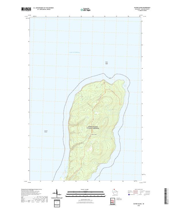
2022 Map of Outer Island
USGS Topo · Published 2022About this map
Outer Island, the northernmost point of the Apostle Islands National Lakeshore, is documented here in a modern survey of its terrestrial and aquatic boundaries. Surrounded by the cold depths of Lake Superior, the land is traversed by the North-South Trl and the shorter Lullabye Trl near the northeastern shore. These pathways imply the island's use for low-impact recreation and conservation management within the broader Apostle Islands chain. The eastern coastline is punctuated by Austad Bay, while the northern waters are marked by the Outer Island Shoal, indicating the submerged hazards that define the maritime navigation of this isolated landmass.
Find a feature on this map
12 named features on this map. Tap any name to fly to it.
Don’t see what you’re looking for? This feature index may not catch every label — zoom into the map to look around manually.
Map Details
Editions of this 2022 Outer Island Map
This is the sole edition of this map. No revisions or reprints were ever made.
Other maps of this area

1953 · Ashland
USGS Topo · 1:250,000

1954 · Two Harbors
USGS Topo · 1:250,000

1957 · Two Harbors
USGS Topo · 1:250,000

1958 · Ashland
USGS Topo · 1:250,000

1958 · Two Harbors
USGS Topo · 1:250,000
1963 · Outer Island
USGS Topo · 1:62,500

1963 · Cat Island
USGS Topo · 1:24,000

1963 · Michigan Island
USGS Topo · 1:24,000

1963 · Rocky Island
USGS Topo · 1:62,500
1963 · Outer Island
USGS Topo · 1:24,000