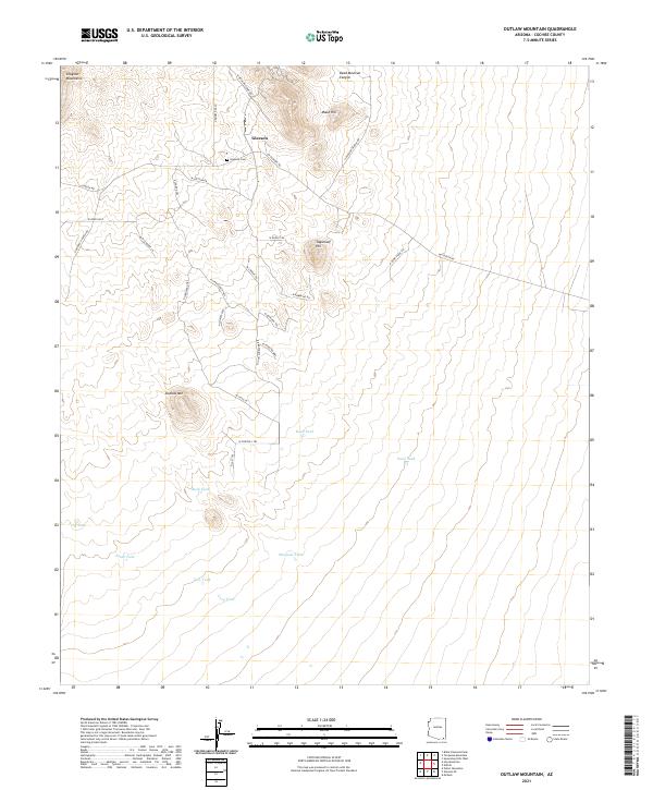
2021 Map of Outlaw Mountain
USGS Topo · Published 2021About this map
Gleeson and the surrounding high desert of Cochise County are recorded here in great detail, showing the settlement positioned beneath the eastern slopes of the Dragoon Mountains. This region, characterized by its arid landscape and isolated peaks, features prominent landmarks such as Maud Hill and Sugarloaf Hill. For genealogists and local historians, the Gleeson Cem serves as a critical point of reference for the families who once worked the nearby mines and ranches.
Find a feature on this map
43 named features on this map. Tap any name to fly to it.
Don’t see what you’re looking for? This feature index may not catch every label — zoom into the map to look around manually.
Map Details
Editions of this 2021 Outlaw Mountain Map
This is the sole edition of this map. No revisions or reprints were ever made.
Other maps of this area

1916 · Pearce
USGS Topo · 1:125,000

1922 · Swisshelm
USGS Topo · 1:62,500

1925 · Gleeson
USGS Topo · 1:62,500

1926 · Light
USGS Topo · 1:62,500

1926 · Courtland
USGS Topo · 1:62,500

1955 · Douglas
USGS Topo · 1:250,000
1957 · Hay Mountain
USGS Topo · 1:24,000

1958 · Squaretop Hills
USGS Topo · 1:62,500

1958 · Swisshelm Mtn
USGS Topo · 1:62,500

1958 · Pearce
USGS Topo · 1:62,500