
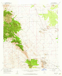
1958 Map of Pearce
USGS Topo · Published 1959About this map
Sulphur Spring Valley and the steep eastern slopes of the Dragoon Mountains define this late-1950s landscape of mining and ranching. The mining town of Pearce serves as a focal point, situated near the Commonwealth Mine and Sixmile Hill. The area's hard-rock history is visible through a high density of claims and workings including the Standard Tungsten Mine, Cobre Loma Mine, and the Herget Turquoise Mine near Turquoise Mtn.
Find a feature on this map
61 named features on this map. Tap any name to fly to it.
Don’t see what you’re looking for? This feature index may not catch every label — zoom into the map to look around manually.
Map Details
Editions of this 1958 Pearce Map
2 editions found
Other maps of this area

1915 · Benson
USGS Topo · 1:125,000

1916 · Pearce
USGS Topo · 1:125,000

1922 · Willcox
USGS Topo · 1:125,000

1922 · Swisshelm
USGS Topo · 1:62,500

1922 · St. David
USGS Topo · 1:62,500

1925 · Gleeson
USGS Topo · 1:62,500

1926 · Light
USGS Topo · 1:62,500

1926 · Courtland
USGS Topo · 1:62,500

1932 · Fairbank
USGS Topo · 1:62,500

1943 · Dos Cabezas
USGS Topo · 1:62,500