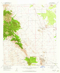
1958 Map of Pearce
USGS Topo · Published 1962About this map
Sulphur Springs Valley dominates this 1958 survey, where the flat basin floor meets the steep rise of the Dragoon Mountains. The mapping captures a landscape defined by its mining heritage and cattle ranching, most notably at the settlement of Pearce near the Commonwealth Mine. Further south, the mining town of Courtland sits at the base of Turquoise Mtn, surrounded by historical workings like the Side Hill Claim and the Old Turquoise Mine. Trace the path of an Old Railroad Grade that once connected these boomtowns to wider markets.
Find a feature on this map
69 named features on this map. Tap any name to fly to it.
Don’t see what you’re looking for? This feature index may not catch every label — zoom into the map to look around manually.
Map Details
Editions of this 1958 Pearce Map
2 editions found

Other maps of this area

1915 · Benson
USGS Topo · 1:125,000

1916 · Pearce
USGS Topo · 1:125,000

1922 · Willcox
USGS Topo · 1:125,000

1922 · Swisshelm
USGS Topo · 1:62,500

1922 · St. David
USGS Topo · 1:62,500

1925 · Gleeson
USGS Topo · 1:62,500

1926 · Light
USGS Topo · 1:62,500

1926 · Courtland
USGS Topo · 1:62,500

1932 · Fairbank
USGS Topo · 1:62,500

1943 · Dos Cabezas
USGS Topo · 1:62,500