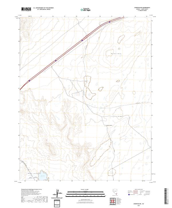
2021 Map of Overton NW
USGS Topo · Published 2021About this map
Mormon Mesa dominates the northern landscape of this Clark County region, where the high flatland drops away toward the Mojave Desert floor. In the southwest corner, the Moapa Valley provides a stark contrast to the surrounding arid terrain, anchored by the presence of Bowman Reservoir. This area reflects a desert environment defined by its natural topography rather than dense settlement, with the land divided into sections including t14s r67e and t14s r68e. Modern infrastructure is represented by N Moapa Valley Blvd and Bowman Rd, while the long reach of Carp Elgin Rd cuts across the mesa, tracing a path through this remote Nevada corridor where water management and open range meet.
Find a feature on this map
12 named features on this map. Tap any name to fly to it.
Don’t see what you’re looking for? This feature index may not catch every label — zoom into the map to look around manually.
Map Details
Editions of this 2021 Overton NW Map
This is the sole edition of this map. No revisions or reprints were ever made.
Other maps of this area

1886 · Saint Thomas
USGS Topo · 1:250,000

1893 · Saint Thomas
USGS Topo · 1:250,000

1954 · Las Vegas
USGS Topo · 1:250,000

1957 · Las Vegas
USGS Topo · 1:250,000

1958 · Moapa
USGS Topo · 1:62,500

1958 · Overton
USGS Topo · 1:62,500

1959 · Las Vegas
USGS Topo · 1:250,000

1962 · Las Vegas
USGS Topo · 1:250,000
1969 · Rox SE
USGS Topo · 1:24,000
1969 · Moapa Peak
USGS Topo · 1:24,000