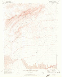
1969 Map of Moapa Peak
USGS Topo · Published 1972About this map
Moapa Peak dominates the northern reaches of this 1960s desert landscape, standing as a primary landmark within the Mormon Mountains. The terrain transitions from these high peaks down into the expansive Mormon Mesa to the south, a region marked by steep escarpments and complex drainage patterns. This survey, based on 1967 aerial photography, captures the isolation of the area at the border of Lincoln and Clark Counties. Evidence of land use is sparse but significant, with a Corral and isolated Ruins suggesting intermittent ranching or historical habitation. Water management in this arid environment is highlighted by the Sheep Canyon Reservoir, while a primitive Jeep Trail winds through the Mormon Jacks Pockets, providing one of the few navigable routes through the high desert breaks.
Find a feature on this map
9 named features on this map. Tap any name to fly to it.
Don’t see what you’re looking for? This feature index may not catch every label — zoom into the map to look around manually.
Map Details
Editions of this 1969 Moapa Peak Map
2 editions found
Other maps of this area

1886 · Saint Thomas
USGS Topo · 1:250,000

1893 · Saint Thomas
USGS Topo · 1:250,000

1954 · Las Vegas
USGS Topo · 1:250,000

1957 · Las Vegas
USGS Topo · 1:250,000

1958 · Moapa
USGS Topo · 1:62,500

1958 · Overton
USGS Topo · 1:62,500

1959 · Las Vegas
USGS Topo · 1:250,000

1962 · Las Vegas
USGS Topo · 1:250,000
1969 · Rox NE
USGS Topo · 1:24,000
1969 · Rox SE
USGS Topo · 1:24,000