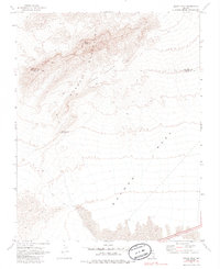
1969 Map of Moapa Peak
USGS Topo · Published 1985About this map
Moapa Peak stands as the dramatic high point of the Moapa Mountains in this desert landscape, where the rugged topography drops away toward the expansive flats of Mormon Mesa. The map details a transition from the complex ridgelines and drainages of the Mormon Jacks Pockets to the more gradual slopes leading south. A solitary Sheep Canyon Reservoir appears in the western drainage, a rare water management feature in an otherwise arid environment. Along the northern edge, the Lincoln Co Clark Co line indicates the administrative divide within this portion of the Mojave Desert. The presence of several Jeep Trails snaking through the washes and over ridges highlights the reliance on off-road transit for accessing these remote peaks and canyons during the late 1960s.
Find a feature on this map
7 named features on this map. Tap any name to fly to it.
Don’t see what you’re looking for? This feature index may not catch every label — zoom into the map to look around manually.
Map Details
Editions of this 1969 Moapa Peak Map
2 editions found
Other maps of this area

1886 · Saint Thomas
USGS Topo · 1:250,000

1893 · Saint Thomas
USGS Topo · 1:250,000

1954 · Las Vegas
USGS Topo · 1:250,000

1957 · Las Vegas
USGS Topo · 1:250,000

1958 · Moapa
USGS Topo · 1:62,500

1958 · Overton
USGS Topo · 1:62,500

1959 · Las Vegas
USGS Topo · 1:250,000

1962 · Las Vegas
USGS Topo · 1:250,000
1969 · Rox NE
USGS Topo · 1:24,000
1969 · Rox SE
USGS Topo · 1:24,000