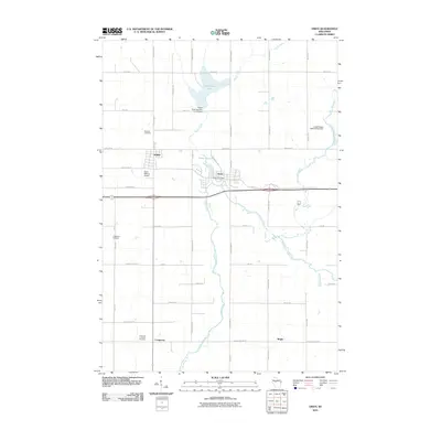
2010 Map of Owen
USGS Topo · Published 2010About this map
The Popple River and its various forks define the central landscape of this Clark County survey, winding past the neighboring communities of Owen and Withee. This era shows a region balanced between municipal development and water management, evidenced by the Owen City Dam and the Owen Pond. Outside the town centers, the land is organized by a grid of rural routes like Hixwood Rd and County Hwy-T, connecting agricultural reaches and small settlements. For genealogists and local historians, several key sites are preserved, including the Nazareth Cemetery north of the village and the Emanuel Lutheran Cemetery near Longwood. The presence of the Owen-Withee Airport underscores the logistical role of this area within the larger Wisconsin interior during the early 21st century.
Find a feature on this map
40 named features on this map. Tap any name to fly to it.
Don’t see what you’re looking for? This feature index may not catch every label — zoom into the map to look around manually.
Map Details
Editions of this 2010 Owen Map
This is the sole edition of this map. No revisions or reprints were ever made.
Other maps of this area

1951 · Lublin
USGS Topo · 1:48,000

1951 · Medford
USGS Topo · 1:48,000

1953 · Abbotsford
USGS Topo · 1:48,000

1953 · Owen
USGS Topo · 1:48,000

1953 · Eau Claire
USGS Topo · 1:250,000

1953 · Rice Lake
USGS Topo · 1:250,000

1958 · Eau Claire
USGS Topo · 1:250,000

1959 · Rice Lake
USGS Topo · 1:250,000

1963 · Abbotsford
USGS Topo · 1:62,500

1963 · Owen
USGS Topo · 1:62,500