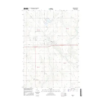
2015 Map of Owen
USGS Topo · Published 2015About this map
The city of Owen and neighboring Withee serve as the primary hubs in this central Wisconsin landscape, situated along a prominent east-west corridor. To the south, the settlement of Longwood sits near the winding course of the Popple River, which is fed by the North Fork Popple River and South Fork Popple River. The terrain is characterized by its hydraulic network, including Sportsman Lake to the north and Owen Pond near the urban center. Local genealogy is anchored by established sites such as Nazareth Cem and the Emanuel Lutheran Cem, reflecting the area's rural heritage. The grid of county roads, including Co Rd X and Co Rd N, connects these communities across the township lines of t29n r2w and t29n r1w, illustrating the modern development of Clark County’s agricultural and residential layout.
Find a feature on this map
52 named features on this map. Tap any name to fly to it.
Don’t see what you’re looking for? This feature index may not catch every label — zoom into the map to look around manually.
Map Details
Editions of this 2015 Owen Map
This is the sole edition of this map. No revisions or reprints were ever made.
Other maps of this area

1951 · Lublin
USGS Topo · 1:48,000

1951 · Medford
USGS Topo · 1:48,000

1953 · Abbotsford
USGS Topo · 1:48,000

1953 · Owen
USGS Topo · 1:48,000

1953 · Eau Claire
USGS Topo · 1:250,000

1953 · Rice Lake
USGS Topo · 1:250,000

1958 · Eau Claire
USGS Topo · 1:250,000

1959 · Rice Lake
USGS Topo · 1:250,000

1963 · Abbotsford
USGS Topo · 1:62,500

1963 · Owen
USGS Topo · 1:62,500