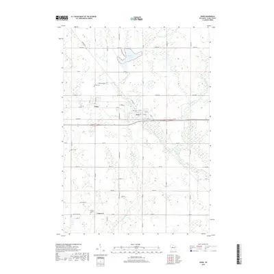
2018 Map of Owen
USGS Topo · Published 2018About this map
Owen and Withee serve as the primary hubs of this Clark County landscape, where the urban grid meets a network of rural routes and river drainages. The area is defined by its water systems, including the Popple River and its various branches, such as the South Fork Popple River and North Fork Popple River, which meander through the terrain alongside Brick Cr. Local recreation and industry are marked by Sportsman Lake and Owen Pond, situated just north of the central corridor.
Find a feature on this map
26 named features on this map. Tap any name to fly to it.
Don’t see what you’re looking for? This feature index may not catch every label — zoom into the map to look around manually.
Map Details
Editions of this 2018 Owen Map
This is the sole edition of this map. No revisions or reprints were ever made.
Other maps of this area

1951 · Lublin
USGS Topo · 1:48,000

1951 · Medford
USGS Topo · 1:48,000

1953 · Abbotsford
USGS Topo · 1:48,000

1953 · Owen
USGS Topo · 1:48,000

1953 · Eau Claire
USGS Topo · 1:250,000

1953 · Rice Lake
USGS Topo · 1:250,000

1958 · Eau Claire
USGS Topo · 1:250,000

1959 · Rice Lake
USGS Topo · 1:250,000

1963 · Abbotsford
USGS Topo · 1:62,500

1963 · Owen
USGS Topo · 1:62,500