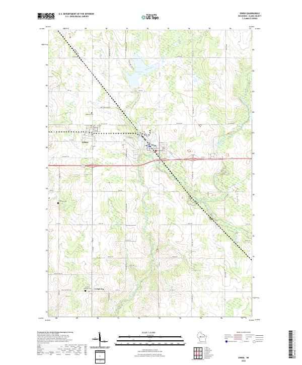
2022 Map of Owen
USGS Topo · Published 2022About this map
Owen and Withee anchor this section of Clark County, sitting at the junction of the area's primary transportation routes including Co Rd X and the local grid. The landscape is defined by the drainage basins of the Popple River and its tributaries, the North Fork Popple River and South Fork Popple River. To the north, Sportsman Lake and Brick Creek indicate the low-lying wetland character that persists throughout the region. For genealogists and local historians, the map provides precise locations for Nazareth Cem, Longwood Cem, and Emanuel Lutheran Cem, which are associated with the smaller settlement of Longwood to the south. The development pattern follows a strict rectangular survey system, with namesake rural routes like Bruckshlager Rd, Nerdrum Dr, and Borglin Ave reflecting the family legacies of the farming community.
Find a feature on this map
50 named features on this map. Tap any name to fly to it.
Don’t see what you’re looking for? This feature index may not catch every label — zoom into the map to look around manually.
Map Details
Editions of this 2022 Owen Map
This is the sole edition of this map. No revisions or reprints were ever made.
Other maps of this area

1951 · Lublin
USGS Topo · 1:48,000

1951 · Medford
USGS Topo · 1:48,000

1953 · Abbotsford
USGS Topo · 1:48,000

1953 · Owen
USGS Topo · 1:48,000

1953 · Eau Claire
USGS Topo · 1:250,000

1953 · Rice Lake
USGS Topo · 1:250,000

1958 · Eau Claire
USGS Topo · 1:250,000

1959 · Rice Lake
USGS Topo · 1:250,000

1963 · Abbotsford
USGS Topo · 1:62,500

1963 · Owen
USGS Topo · 1:62,500