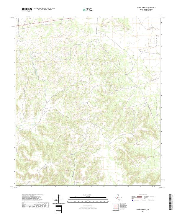
2022 Map of Owens Creek SE
USGS Topo · Published 2022About this map
Owens Cr winds through this section of the Edwards Plateau, where the landscape is defined by the deep incisions of Mailbox Draw and Howard Draw. The map documents a predominantly rural and ranch-oriented environment in Crockett County, characterized by a sparse network of local roads that navigate the complex topography of the draws. Notable transport corridors include Vic Montgomery Rd and several county routes such as Cr 301 and Cr 302. This survey reflects the modern geographic state of this West Texas terrain, illustrating how land use is tied closely to the intermittent watercourses and the relief of the surrounding draws.
Find a feature on this map
7 named features on this map. Tap any name to fly to it.
Don’t see what you’re looking for? This feature index may not catch every label — zoom into the map to look around manually.
Map Details
Editions of this 2022 Owens Creek SE Map
This is the sole edition of this map. No revisions or reprints were ever made.
Other maps of this area

1929 · Sheffield
USGS Topo · 1:125,000

1954 · Sonora
USGS Topo · 1:250,000

1958 · Sonora
USGS Topo · 1:250,000

1967 · Owens Creek SE
USGS Topo · 1:24,000

1967 · Owens Creek NE
USGS Topo · 1:24,000

1967 · Schneeman Draw NW
USGS Topo · 1:24,000

1967 · Pikes Peak
USGS Topo · 1:24,000
1967 · Schneeman Draw SW
USGS Topo · 1:24,000

1967 · Fort Lancaster
USGS Topo · 1:24,000

1967 · Bachelor Hill
USGS Topo · 1:24,000