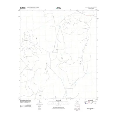
2010 Map of Owens Creek SW
USGS Topo · Published 2010About this map
Owens Ranch and Hoover Ranch anchor this West Texas landscape, illustrating the enduring presence of large-scale ranching operations in Crockett County. The terrain is defined by a network of seasonal watercourses and deep incisions, including Knute Draw, Double Tank Canyon, and J M Canyon, all draining toward the primary arteries of Live Oak Creek and Owens Creek.
Find a feature on this map
11 named features on this map. Tap any name to fly to it.
Don’t see what you’re looking for? This feature index may not catch every label — zoom into the map to look around manually.
Map Details
Editions of this 2010 Owens Creek SW Map
This is the sole edition of this map. No revisions or reprints were ever made.
Other maps of this area

1929 · Sheffield
USGS Topo · 1:125,000

1954 · Sonora
USGS Topo · 1:250,000

1958 · Sonora
USGS Topo · 1:250,000

1967 · Owens Creek SE
USGS Topo · 1:24,000

1967 · Owens Creek NE
USGS Topo · 1:24,000

1967 · Twelvemile Camp
USGS Topo · 1:24,000

1967 · Deer Canyon
USGS Topo · 1:24,000

1967 · Fort Lancaster
USGS Topo · 1:24,000

1967 · Bachelor Hill
USGS Topo · 1:24,000
1967 · Owens Creek SW
USGS Topo · 1:24,000