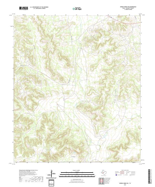
2022 Map of Owens Creek SW
USGS Topo · Published 2022About this map
Live Oak Cr and its tributaries carve a complex network of drainage systems through this part of Crockett County, defining a landscape dominated by canyon and draw formations. This modern topographic study reveals the sparse ranching infrastructure of West Texas, where local travel is facilitated by corridors like Deer Canyon Rd and Live Oak Rd. Significant hydrologic features such as Live Oak Spring provide essential water points in this arid environment, while the branching reaches of Owens Cr dominate the eastern portion of the quadrangle. The map captures the distinct geographic signatures of the Edwards Plateau, noted by the deep indentations of Double Tank Canyon, J M Canyon, and the elongated Knute Draw, which trace the natural movement of water across this high-plains terrain.
Find a feature on this map
9 named features on this map. Tap any name to fly to it.
Don’t see what you’re looking for? This feature index may not catch every label — zoom into the map to look around manually.
Map Details
Editions of this 2022 Owens Creek SW Map
This is the sole edition of this map. No revisions or reprints were ever made.
Other maps of this area

1929 · Sheffield
USGS Topo · 1:125,000

1954 · Sonora
USGS Topo · 1:250,000

1958 · Sonora
USGS Topo · 1:250,000

1967 · Owens Creek SE
USGS Topo · 1:24,000

1967 · Owens Creek NE
USGS Topo · 1:24,000

1967 · Twelvemile Camp
USGS Topo · 1:24,000

1967 · Deer Canyon
USGS Topo · 1:24,000

1967 · Fort Lancaster
USGS Topo · 1:24,000

1967 · Bachelor Hill
USGS Topo · 1:24,000
1967 · Owens Creek SW
USGS Topo · 1:24,000