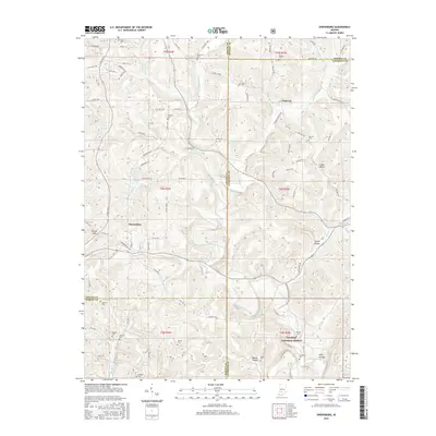
2016 Map of Owensburg
USGS Topo · Published 2016About this map
Owensburg serves as a primary settlement in this corner of Greene County, situated near the headwaters of Town Br. The landscape is defined by its numerous small hollows and ridges, including Linden Hollow and Poplar Ridge, which fall within the southwestern reaches of the Hoosier National Forest. This 2016 survey documents a rural environment where land use is dictated by the drainage patterns of Indian Creek and its many tributaries like Cole Br and Popcorn Cr.
Find a feature on this map
102 named features on this map. Tap any name to fly to it.
Don’t see what you’re looking for? This feature index may not catch every label — zoom into the map to look around manually.
Map Details
Editions of this 2016 Owensburg Map
This is the sole edition of this map. No revisions or reprints were ever made.
Other maps of this area

1908 · Bloomington
USGS Topo · 1:48,000

1908 · Bloomfield
USGS Topo · 1:62,500

1910 · Bloomington
USGS Topo · 1:62,500

1935 · Oolitic
USGS Topo · 1:48,000

1942 · Oolitic
USGS Topo · 1:62,500

1953 · Indianapolis
USGS Topo · 1:250,000

1956 · Indianapolis
USGS Topo · 1:250,000
1956 · Clear Creek
USGS Topo · 1:24,000
1956 · Stanford
USGS Topo · 1:24,000

1956 · Koleen
USGS Topo · 1:24,000