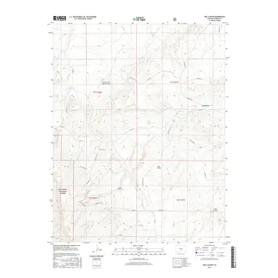
2016 Map of Owl Canyon
USGS Topo · Published 2016About this map
San Isabel National Forest dominates the southwestern reaches of this Colorado landscape, where the terrain transitions into a complex network of drainage systems and deep canyons. The settlement of Bronquist serves as a primary reference point in the eastern portion of the map, situated near the intersection of Bronquist RD and Co RD 200. The area is characterized by dramatic elevation changes, with named landforms like Owl Canyon, Gold Canyon, and Lopez Canyon carving through the high country. Water management is evident through features such as Gains Reservoir and a series of creeks, including Rush Cr, Peck Cr, and Soda Cr, which define the natural flow of the territory. A dense network of forest and county roads, such as Siloam Rd and National Forest Dr, provides access to the interior of the timberlands and the Left Hand Fork Logging Canyon.
Find a feature on this map
39 named features on this map. Tap any name to fly to it.
Don’t see what you’re looking for? This feature index may not catch every label — zoom into the map to look around manually.
Map Details
Editions of this 2016 Owl Canyon Map
This is the sole edition of this map. No revisions or reprints were ever made.
Other maps of this area

1889 · Canon City
USGS Topo · 1:125,000

1891 · Pueblo
USGS Topo · 1:125,000

1892 · Canon City
USGS Topo · 1:125,000

1894 · Pueblo
USGS Topo · 1:125,000

1896 · Pueblo
USGS Topo · 1:125,000

1897 · Pueblo
USGS Topo · 1:125,000

1954 · Pueblo
USGS Topo · 1:250,000

1957 · Pueblo
USGS Topo · 1:250,000

1958 · Pueblo
USGS Topo · 1:250,000
1959 · Florence SE
USGS Topo · 1:24,000