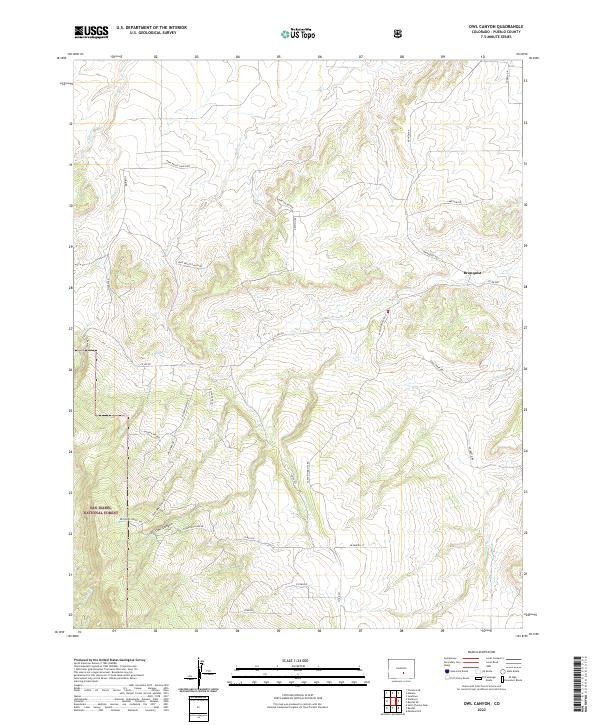
2022 Map of Owl Canyon
USGS Topo · Published 2022About this map
San Isabel National Forest anchors the southwestern terrain of this quadrangle, where the steep topography of Owl Canyon descends toward the plains of Pueblo County. The settlement at Bronquist sits near the junction of Bronquist Rd and Co Rd 200, serving as a primary point of human activity amidst a landscape defined by seasonal drainages and ranch access roads. Waterways including Peck Cr, Soda Cr, and Rush Cr carve through the foothills, indicating the complex drainage patterns of the high Colorado tablelands. Local history is reflected in the naming of travel routes such as Pope Valley Ranch Rd and Old Homestead Ln, which hint at the region's agricultural and pastoral roots. Modern residential development is visible along San Isabel Dr and Canyon Heights Rd, contrasting with the more primitive tracks like Newton Rd that penetrate the higher elevations.
Find a feature on this map
37 named features on this map. Tap any name to fly to it.
Don’t see what you’re looking for? This feature index may not catch every label — zoom into the map to look around manually.
Map Details
Editions of this 2022 Owl Canyon Map
This is the sole edition of this map. No revisions or reprints were ever made.
Other maps of this area

1889 · Canon City
USGS Topo · 1:125,000

1891 · Pueblo
USGS Topo · 1:125,000

1892 · Canon City
USGS Topo · 1:125,000

1894 · Pueblo
USGS Topo · 1:125,000

1896 · Pueblo
USGS Topo · 1:125,000

1897 · Pueblo
USGS Topo · 1:125,000

1954 · Pueblo
USGS Topo · 1:250,000

1957 · Pueblo
USGS Topo · 1:250,000

1958 · Pueblo
USGS Topo · 1:250,000
1959 · Florence SE
USGS Topo · 1:24,000