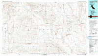
1993 Map of Owlshead Mountains
USGS Topo · Published 1993About this map
Death Valley National Monument dominates this landscape, showing a complex network of mining sites and desert hydrology at the close of the twentieth century. The map traces the industrial history of the region through numerous gold and silver operations, from the Queen of Sheba Mine in the north to the Black Magic Mine in the south. The transition from active settlements to historical markers is evident at Ashford Mill (Ruins) and the Confidence Mill (Site). Water sources dictate the geography of the basin, with the Amargosa River cutting through the Beys Hills toward the Silurian Lake bed. Large swaths of territory are cordoned off for government use, including the Fort Irwin Military Reservation and the China Lake Naval Weapons Center, illustrating the region's mid-century shift toward military utility.
Find a feature on this map
55 named features on this map. Tap any name to fly to it.
Don’t see what you’re looking for? This feature index may not catch every label — zoom into the map to look around manually.
Map Details
Editions of this 1993 Owlshead Mountains Map
This is the sole edition of this map. No revisions or reprints were ever made.
Other maps of this area

1907 · Las Vegas
USGS Topo · 1:250,000

1908 · Furnace Creek
USGS Topo · 1:250,000

1908 · Las Vegas
USGS Topo · 1:250,000

1908 · Ballarat
USGS Topo · 1:250,000

1910 · Furnace Creek
USGS Topo · 1:250,000

1910 · Ivanpah
USGS Topo · 1:250,000

1912 · Ivanpah
USGS Topo · 1:250,000

1913 · Ballarat
USGS Topo · 1:250,000

1915 · Searles Lake
USGS Topo · 1:250,000

1933 · Avawatz Mountains
USGS Topo · 1:250,000