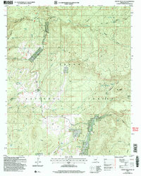
2004 Map of Oxbow Mountain
USGS Topo · Published 2006About this map
Tonto National Forest defines the character of this rugged landscape, where high-country drainage systems like Haigler Creek and Cherry Creek carve deep into the Arizona terrain. The map captures a high-elevation network of canyons and springs that supported early ranching and transit through Gila County, most notably seen in the path of the Chamberlain Trail. This historic route winds through the western portion of the sheet, passing landmarks such as Oxbow Mountain and numerous stock tanks including Fillmore Tank and Bar X Tank.
Find a feature on this map
57 named features on this map. Tap any name to fly to it.
Don’t see what you’re looking for? This feature index may not catch every label — zoom into the map to look around manually.
Map Details
Editions of this 2004 Oxbow Mountain Map
This is the sole edition of this map. No revisions or reprints were ever made.
Other maps of this area

1886 · Holbrook
USGS Topo · 1:250,000

1887 · Verde
USGS Topo · 1:250,000

1892 · Verde
USGS Topo · 1:250,000

1893 · Holbrook
USGS Topo · 1:250,000

1934 · Promontory Butte
USGS Topo · 1:62,500

1937 · Diamond Butte
USGS Topo · 1:48,000

1939 · Promontory Butte
USGS Topo · 1:62,500

1943 · Diamond Butte
USGS Topo · 1:62,500

1952 · Promontory Butte
USGS Topo · 1:62,500

1954 · Holbrook
USGS Topo · 1:250,000