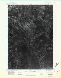
1975 Map of Oxbow NE
USGS Topo · Published 1981About this map
Masardis and Griswold mark the human presence in this heavily forested section of Aroostook County, where the landscape is defined by the winding course of the Aroostook River. This 1975 orthophotoquad provides a clear aerial perspective of the timberlands during a period of transition in Maine's northern interior. The imagery highlights the stark contrast between the dense woodland and the cleared corridors carved by the St Croix Stream and the occasional logging roads or rail beds that cross the terrain. Near the western edge, the dark waters of Cranberry Pond stand out against the surrounding forest, illustrating the boggy and undeveloped character of the region. The spatial relationship between the river and these small settlements reflects the historic dependence of the local economy on water-driven transport and the lumber industry.
Find a feature on this map
5 named features on this map. Tap any name to fly to it.
Don’t see what you’re looking for? This feature index may not catch every label — zoom into the map to look around manually.
Map Details
Editions of this 1975 Oxbow NE Map
This is the sole edition of this map. No revisions or reprints were ever made.
Other maps of this area

1931 · Ashland
USGS Topo · 1:48,000

1934 · Ashland
USGS Topo · 1:62,500

1935 · Howe Brook
USGS Topo · 1:48,000

1935 · Presque Isle
USGS Topo · 1:62,500

1939 · Howe Brook
USGS Topo · 1:62,500

1940 · Oxbow
USGS Topo · 1:62,500

1942 · Oxbow
USGS Topo · 1:62,500

1953 · Ashland
USGS Topo · 1:62,500

1953 · Presque Isle
USGS Topo · 1:62,500

1954 · Howe Brook
USGS Topo · 1:62,500