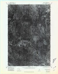
1975 Map of Oxbow NW
USGS Topo · Published 1981About this map
The Aroostook River carves a winding path through this portion of Aroostook County, Maine, as it appeared in the mid-1970s. This orthophotographic study reveals the intricate hydrology of the northern woods, defined by the convergence of the West Branch and several tributaries including Trout Brook and Houlton Brook. The settlement of Oxbow sits along the river's edge, surrounded by timbered terrain that shows the distinct geometric signatures of forest management and clearings of the era. Unlike traditional topographic maps, this aerial imagery provides a direct visual record of the vegetation density and the precise routes of primitive roads and logging tracks that connected the river settlements to the deep interior of the Maine forest. It captures a moment in the region's long history as a center for lumbering and river-based transport.
Find a feature on this map
6 named features on this map. Tap any name to fly to it.
Don’t see what you’re looking for? This feature index may not catch every label — zoom into the map to look around manually.
Map Details
Editions of this 1975 Oxbow NW Map
This is the sole edition of this map. No revisions or reprints were ever made.
Other maps of this area

1930 · Greenlaw
USGS Topo · 1:48,000

1931 · Ashland
USGS Topo · 1:48,000

1933 · Greenlaw
USGS Topo · 1:62,500

1934 · Ashland
USGS Topo · 1:62,500

1940 · Oxbow
USGS Topo · 1:62,500

1942 · Oxbow
USGS Topo · 1:62,500

1953 · Ashland
USGS Topo · 1:62,500

1954 · Grand Lake Seboeis
USGS Topo · 1:62,500

1954 · Presque Isle
USGS Topo · 1:250,000

1958 · Presque Isle
USGS Topo · 1:250,000