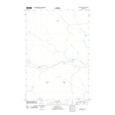
2011 Map of Oxbow West
USGS Topo · Published 2011About this map
The Aroostook River winds through this northern Maine landscape, serving as a primary corridor for a region defined by its timbered ridges and extensive waterways. This 2011 survey captures a quiet, wooded interior where terrain features like Orr Ridge and Sugar Berth Ridge rise above a complex network of streams and still waters. Local history is anchored by names such as Junkins Camp and the nearby Junkins Island, reflecting early settlement and land use in Oxbow North Township. The presence of Arbo Flats and the curiously named Old Maid Rock along the riverbank suggests landmarks familiar to generations of woodsmen and river travelers. To the south, the terrain transitions into significant wetland areas including Lower LaPomkeag Lake and the Dead Brook Deadwater, illustrating the hydrologic character of the North Woods. This map documents a period of modern forestry access via routes like Macdonald Rd while the names of Smith Brook Ridge and Hayden Brook preserve the area's pioneer heritage.
Find a feature on this map
23 named features on this map. Tap any name to fly to it.
Don’t see what you’re looking for? This feature index may not catch every label — zoom into the map to look around manually.
Map Details
Editions of this 2011 Oxbow West Map
This is the sole edition of this map. No revisions or reprints were ever made.
Other maps of this area

1930 · Greenlaw
USGS Topo · 1:48,000

1931 · Ashland
USGS Topo · 1:48,000

1933 · Greenlaw
USGS Topo · 1:62,500

1934 · Ashland
USGS Topo · 1:62,500

1940 · Oxbow
USGS Topo · 1:62,500

1942 · Oxbow
USGS Topo · 1:62,500

1953 · Ashland
USGS Topo · 1:62,500

1954 · Grand Lake Seboeis
USGS Topo · 1:62,500

1954 · Presque Isle
USGS Topo · 1:250,000

1958 · Presque Isle
USGS Topo · 1:250,000