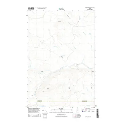
2014 Map of Oxbow West
USGS Topo · Published 2014About this map
Oxbow sits along the southern banks of the Aroostook River, marking a key settlement point in this stretch of northern Maine. The river dominates the central landscape, featuring natural landmarks such as Arbo Flats, Junkins Island, and the turbulent waters of Baste Rips. To the south, the terrain rises sharply into a series of timbered highlands including Sugar Berth Ridge and Smith Brook Ridge, while the northern section is defined by Orr Ridge and Vidal Ridge.
Find a feature on this map
31 named features on this map. Tap any name to fly to it.
Don’t see what you’re looking for? This feature index may not catch every label — zoom into the map to look around manually.
Map Details
Editions of this 2014 Oxbow West Map
This is the sole edition of this map. No revisions or reprints were ever made.
Other maps of this area

1930 · Greenlaw
USGS Topo · 1:48,000

1931 · Ashland
USGS Topo · 1:48,000

1933 · Greenlaw
USGS Topo · 1:62,500

1934 · Ashland
USGS Topo · 1:62,500

1940 · Oxbow
USGS Topo · 1:62,500

1942 · Oxbow
USGS Topo · 1:62,500

1953 · Ashland
USGS Topo · 1:62,500

1954 · Grand Lake Seboeis
USGS Topo · 1:62,500

1954 · Presque Isle
USGS Topo · 1:250,000

1958 · Presque Isle
USGS Topo · 1:250,000