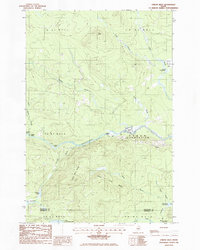
1986 Map of Oxbow West
USGS Topo · Published 1986About this map
The Aroostook River winds through this northern Maine landscape, serving as the central axis for Oxbow Plantation during the mid-1980s. This territory is defined by its complex hydrology and the legacy of timber management, evidenced by the numerous brooks and distinctive "deadwaters" like Osgood Deadwater and Umcolcus Deadwater. Small settlements and seasonal outposts such as Arbo, Junkins Camp, and the Gate House appear alongside the Oxbow Checkpoint, indicating the controlled access typical of private timberlands in this era. The terrain is marked by prominent elevations like Orr Ridge and Sugar Berth Ridge, which overlook a network of private roads. To the south, the boundary between Aroostook and Penobscot counties cuts through the wilderness near La Pomkeag Lake, illustrating the political divisions in this heavily forested region of the North Maine Woods.
Find a feature on this map
36 named features on this map. Tap any name to fly to it.
Don’t see what you’re looking for? This feature index may not catch every label — zoom into the map to look around manually.
Map Details
Editions of this 1986 Oxbow West Map
This is the sole edition of this map. No revisions or reprints were ever made.
Other maps of this area

1930 · Greenlaw
USGS Topo · 1:48,000

1931 · Ashland
USGS Topo · 1:48,000

1933 · Greenlaw
USGS Topo · 1:62,500

1934 · Ashland
USGS Topo · 1:62,500

1940 · Oxbow
USGS Topo · 1:62,500

1942 · Oxbow
USGS Topo · 1:62,500

1953 · Ashland
USGS Topo · 1:62,500

1954 · Grand Lake Seboeis
USGS Topo · 1:62,500

1954 · Presque Isle
USGS Topo · 1:250,000

1958 · Presque Isle
USGS Topo · 1:250,000