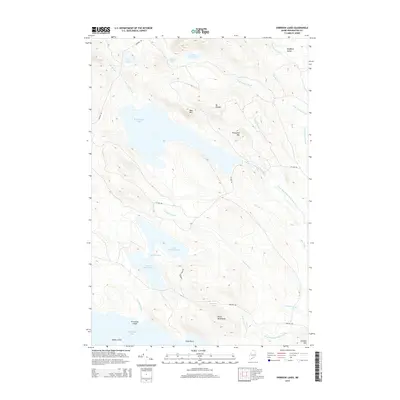
2014 Map of Oxbrook Lakes
USGS Topo · Published 2014About this map
W Musquash Lake and a series of interconnected basins dominate this Washington County landscape, reflecting the glacial hydrology characteristic of eastern Maine. The drainage network is complex, featuring The Thorofare connecting Upper Oxbrook Lake and Lower Oxbrook Lake, eventually flowing into West Grand Lake via Oxbrook Stream. The terrain is punctuated by isolated peaks such as Mt Delight and Porcupine Mtn, which overlook the expansive Bradford Valley to the northeast.
Find a feature on this map
33 named features on this map. Tap any name to fly to it.
Don’t see what you’re looking for? This feature index may not catch every label — zoom into the map to look around manually.
Map Details
Editions of this 2014 Oxbrook Lakes Map
This is the sole edition of this map. No revisions or reprints were ever made.
Other maps of this area

1940 · Waite
USGS Topo · 1:62,500

1941 · Scraggly Lake
USGS Topo · 1:62,500

1941 · Big Lake
USGS Topo · 1:62,500

1941 · Wabassus Lake
USGS Topo · 1:62,500

1942 · Waite
USGS Topo · 1:62,500

1943 · Big Lake
USGS Topo · 1:62,500

1943 · Wabassus Lake
USGS Topo · 1:62,500

1944 · Scraggly Lake
USGS Topo · 1:62,500

1952 · Big Lake
USGS Topo · 1:50,000

1953 · Wabassus Lake
USGS Topo · 1:62,500