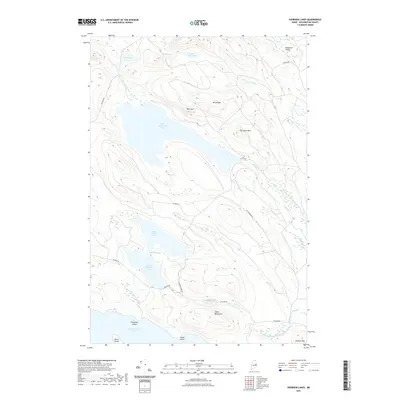
2021 Map of Oxbrook Lakes
USGS Topo · Published 2021About this map
West Musquash Lake and a complex network of waterways dominate this portion of Washington County, reflecting the glacial topography of eastern Maine. The landscape is defined by its massive water bodies, including Upper Oxbrook Lake and Lower Oxbrook Lake, which are connected by a narrow passage known as The Thorofare. To the south, the northern reaches of West Grand Lake appear with Princeton Island and Marks Island, showing a terrain where water and land are deeply integrated. Low mountain ridges such as the Pineo Mountains and Mt Delight rise between the basins, directing the flow of Amazon Brook and the West Branch Big Musquash Stream. The sparse human footprint is limited to a few remote corridors like Amazon Rd and the small settlement at Bradford Valley in the northeast corner.
Find a feature on this map
34 named features on this map. Tap any name to fly to it.
Don’t see what you’re looking for? This feature index may not catch every label — zoom into the map to look around manually.
Map Details
Editions of this 2021 Oxbrook Lakes Map
This is the sole edition of this map. No revisions or reprints were ever made.
Other maps of this area

1940 · Waite
USGS Topo · 1:62,500

1941 · Scraggly Lake
USGS Topo · 1:62,500

1941 · Big Lake
USGS Topo · 1:62,500

1941 · Wabassus Lake
USGS Topo · 1:62,500

1942 · Waite
USGS Topo · 1:62,500

1943 · Big Lake
USGS Topo · 1:62,500

1943 · Wabassus Lake
USGS Topo · 1:62,500

1944 · Scraggly Lake
USGS Topo · 1:62,500

1952 · Big Lake
USGS Topo · 1:50,000

1953 · Wabassus Lake
USGS Topo · 1:62,500