2023 Map of Oxford
USGS Topo · Published 2023About this map
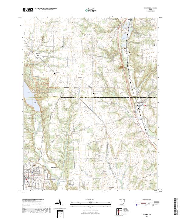
Miami University serves as a major anchor in the southwestern corner of this survey, defining the layout of Oxford as it transitions from a structured university town into the agricultural expanses of Butler and Preble counties. The landscape is defined by the winding paths of Four Mile Creek and Sevenmile Creek, which are flanked by several family-named burial grounds including Ramsey Cem and Beechwood Cem. To the north, the waters of Acton Lake provide a significant recreational landmark near Deep Ford.
Find a feature on this map
103 named features on this map. Tap any name to fly to it.
Don’t see what you’re looking for? This feature index may not catch every label — zoom into the map to look around manually.
Map Details
Editions of this 2023 Oxford Map
This is the sole edition of this map. No revisions or reprints were ever made.
Historical Maps of Austin-Magie Farm and Mill Historic District Through Time

Featured Locations
- Milford Township, OH
- Camden, OH
- Oxford, Oxford Township
- Jericho, Milford Township
- Somerville, Milford Township