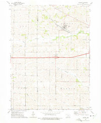
1973 Map of Oxford
USGS Topo · Published 1975About this map
The town of Oxford serves as the primary hub of this 1970s landscape, situated along the tracks of the Chicago Rock Island and Pacific railroad. This rail corridor follows the valley of Rhine Creek, reflecting the traditional reliance on topographic pathways for transportation infrastructure. To the south, the terrain transitions into the more dissected uplands of York and Hardin townships, where North Branch Old Mans Creek and Mooney Creek carve intricate drainage patterns through the Iowa countryside.
Find a feature on this map
20 named features on this map. Tap any name to fly to it.
Don’t see what you’re looking for? This feature index may not catch every label — zoom into the map to look around manually.
Map Details
Editions of this 1973 Oxford Map
This is the sole edition of this map. No revisions or reprints were ever made.
Other maps of this area

1887 · Cedar Rapids
USGS Topo · 1:62,500

1888 · Amana
USGS Topo · 1:62,500

1889 · Amana
USGS Topo · 1:62,500

1891 · Oxford
USGS Topo · 1:62,500

1891 · Cedar Rapids
USGS Topo · 1:62,500

1891 · Iowa City
USGS Topo · 1:62,500

1894 · Oxford
USGS Topo · 1:62,500

1899 · Amana
USGS Topo · 1:62,500

1903 · Fairfax
USGS Topo · 1:125,000

1938 · Iowa City
USGS Topo · 1:62,500