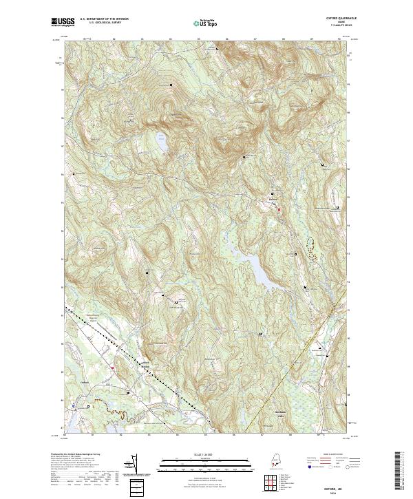
2024 Map of Oxford
USGS Topo · Published 2024About this map
The Little Androscoggin River valley anchors this survey of southern Oxford County, where the historic settlements of Oxford and Hebron are defined by a landscape of prominent peaks and numerous small water bodies. The rail-oriented history of the region is visible at Oxford Station, situated near the confluence of Minister Brook and the main river. To the north, the terrain rises sharply toward Streaked Mountain and Singepole Mtn, interspersed with family-named hills like Sam Rowe Hill and Robinson Hill. Genealogists will find a wealth of burial sites across the township, from the Washburn Memorial Cem near the river to the high-elevation King Hill Cem. Modern infrastructure is represented by the Oxford County Regional Airport, while the eastern edge follows the boundary between Oxford and Androscoggin counties near Mechanic Falls.
Find a feature on this map
128 named features on this map. Tap any name to fly to it.
Don’t see what you’re looking for? This feature index may not catch every label — zoom into the map to look around manually.
Map Details
Editions of this 2024 Oxford Map
This is the sole edition of this map. No revisions or reprints were ever made.
Other maps of this area

1896 · Norway
USGS Topo · 1:62,500

1908 · Poland
USGS Topo · 1:62,500

1911 · Bryant Pond
USGS Topo · 1:62,500

1911 · Buckfield
USGS Topo · 1:62,500

1913 · Buckfield
USGS Topo · 1:62,500

1914 · Bryant Pond
USGS Topo · 1:62,500

1940 · Poland
USGS Topo · 1:62,500

1942 · Buckfield
USGS Topo · 1:62,500

1942 · Bryant Pond
USGS Topo · 1:62,500

1942 · Poland
USGS Topo · 1:62,500