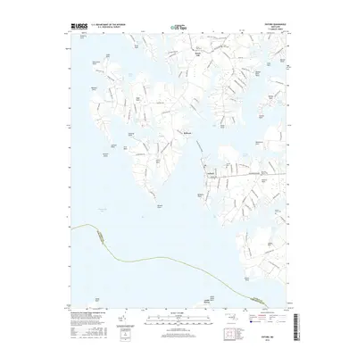
2016 Map of Oxford
USGS Topo · Published 2016About this map
The maritime landscape of the Maryland Eastern Shore is meticulously documented in this 2016 survey, centered on the historic waterfront town of Oxford. The map highlights the area's intricate coastline, where tidal estuaries like Bridge Creek and Irish Cr branch into numerous coves, including Haskins Cove and Elberts Cove. This era shows a community deeply tied to the water, maintained by the functional Oxford Bellevue Ferry connecting Oxford to the village of Bellevue across the Tred Avon. Inland, the legacy of family estates and religious life is marked by sites like Saint Pauls Cem and Old John Wesley Cem. The peninsula of Ferry Neck and the surrounding points, such as Benoni Point and Bachelor Point, illustrate the geographic fragmentation that has long shaped the navigation and development of Talbot County.
Find a feature on this map
116 named features on this map. Tap any name to fly to it.
Don’t see what you’re looking for? This feature index may not catch every label — zoom into the map to look around manually.
Map Details
Editions of this 2016 Oxford Map
This is the sole edition of this map. No revisions or reprints were ever made.
Other maps of this area

1892 · Annapolis
USGS Topo · 1:62,500

1893 · Sharps Island
USGS Topo · 1:62,500

1898 · Choptank
USGS Topo · 1:125,000

1904 · St. Michaels
USGS Topo · 1:62,500

1904 · Annapolis
USGS Topo · 1:62,500

1904 · Sharps Island
USGS Topo · 1:62,500

1904 · Oxford
USGS Topo · 1:62,500

1908 · Choptank
USGS Topo · 1:125,000

1942 · Tilghman
USGS Topo · 1:31,680

1942 · Oxford
USGS Topo · 1:31,680