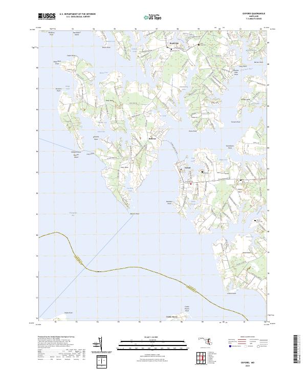
2023 Map of Oxford
USGS Topo · Published 2023About this map
The peninsula landscape of Talbot County is defined here by the confluence of the Tred Avon River and the Chesapeake Bay, where maritime history remains visible in the modern era. The historic Oxford-Bellevue Ferry continues to connect these two distinct waterfront settlements, a reminder of the waterborne transit networks that preceded modern highways. In Oxford, the town plan is densely marked with heritage sites including the Oxford Cem, while nearby Bellevue sits at the end of the Ferry Neck peninsula, surrounded by smaller waterways like Tar Creek and Fox Hole Creek.
Find a feature on this map
127 named features on this map. Tap any name to fly to it.
Don’t see what you’re looking for? This feature index may not catch every label — zoom into the map to look around manually.
Map Details
Editions of this 2023 Oxford Map
This is the sole edition of this map. No revisions or reprints were ever made.
Other maps of this area

1892 · Annapolis
USGS Topo · 1:62,500

1893 · Sharps Island
USGS Topo · 1:62,500

1898 · Choptank
USGS Topo · 1:125,000

1904 · St. Michaels
USGS Topo · 1:62,500

1904 · Annapolis
USGS Topo · 1:62,500

1904 · Sharps Island
USGS Topo · 1:62,500

1904 · Oxford
USGS Topo · 1:62,500

1908 · Choptank
USGS Topo · 1:125,000

1942 · Tilghman
USGS Topo · 1:31,680

1942 · Oxford
USGS Topo · 1:31,680