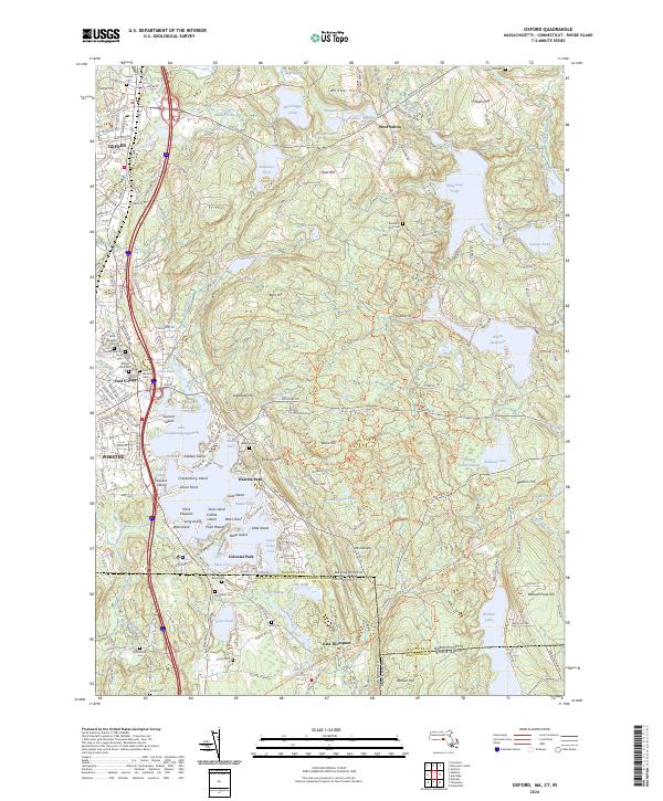
2024 Map of Oxford
USGS Topo · Published 2024About this map
The expansive Lake Chaubunagungamaug dominates the central landscape, its complex shoreline defined by points and islands such as Killdeer Island and Checkerberry Island. This 2024 survey captures the tri-state border region where Massachusetts, Connecticut, and Rhode Island converge near Benson Mtn. The industrial and transit legacy of the corridor is marked by the Providence & Worcester RR, which runs parallel to the French River through the urban centers of Oxford and Webster. Numerous historical burying grounds including South Cem and Pigeon Hill Cem are documented alongside local landmarks like Sutton Falls and the Stockwell school. The terrain transitions from the developed valley floors to upland features like Putnam Hill and Whittier Hill, reflecting the varied settlement patterns of Worcester County.
Find a feature on this map
246 named features on this map. Tap any name to fly to it.
Don’t see what you’re looking for? This feature index may not catch every label — zoom into the map to look around manually.
Map Details
Editions of this 2024 Oxford Map
This is the sole edition of this map. No revisions or reprints were ever made.
Other maps of this area

1886 · Blackstone
USGS Topo · 1:62,500

1889 · Blackstone
USGS Topo · 1:62,500

1889 · Webster
USGS Topo · 1:62,500

1889 · Putnam
USGS Topo · 1:62,500

1889 · Burrillville
USGS Topo · 1:62,500

1892 · Webster
USGS Topo · 1:62,500

1893 · Putnam
USGS Topo · 1:62,500

1893 · Blackstone
USGS Topo · 1:62,500

1894 · Burrillville
USGS Topo · 1:62,500

1900 · Blackstone
USGS Topo · 1:62,500